Satellite & Aerial Imagery Mapping BLOG
-
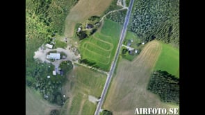
Satellite Imagery & Digital Terrain Model (DTM) Fly Over
-
Orthomosaic and Digital Elevation Models with ZII and ardupilot by Airfoto
-
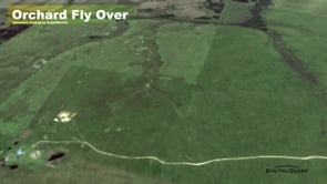
Orchard Fly Over Animation
-
2012 London Olympics Satellite Imagery Package
-
FIFA World Cup Soccer Stadiums
-
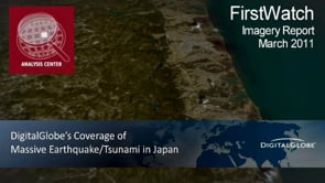
Japan Earthquake & Tsunami DAMAGE ASSESSMENT
-
KMZmaps.com
-
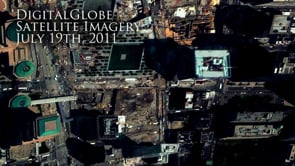
Ground Zero 10 Years Later -- 10th Anniversary of 9-11
-
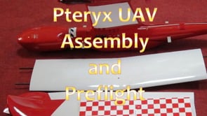
Pteryx UAV assembly and short preflight checking
-
Photosynth + Bing Maps
-
Ed Viesturs -- Vinson Massif Mountain
-
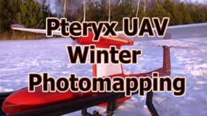
UAV photomapping in winter


Satellite & Aerial Imagery Mapping BLOG

Welcome to the Satellite and Aerial imagery MAPPING visualization blog.
The purpose of this blog is to provide a place where those of you that create maps (that use satellite imagery, aerial imagery or interesting data sets) can share your hard work and creativity. It is also a place to ask questions and get answers.
(As an FYI: Please do NOT post any animations from Google Earth or Virtual Earth. We want to see your work.)
If you have any questions, please send me an email.
All the best,
Sam
email: sam (at symbol) sw3d.bz
ScapeWare3d.com
952-380-0123
Featured
-
World Zoom for Phish Summer Concert Tour
This was a great project we did for Zoo Films, Blip…
-
Golf Course 3d Visualization with Elevation Terrain Data
On this project we worked with a sports production…
-
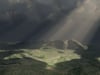
Flagstaff 3d Visualization
Breaks in the clouds following a Flagstaff Rain. While…

Browse This Group
Similar Groups
-
Maps 4 Video Production
This is a channel showcasing some of the maps and animations…
-
Research, Design, Production Group
Research, Design, Production Group's goal is to discover…
-
VJ Torna Hungary 2010 - Online submissions
We accept video applications through this Vimeo group…


Related RSS Feeds
This is a Vimeo Group. Groups allow you to create mini communities around the things you like. Check out other interesting groups. ![]()